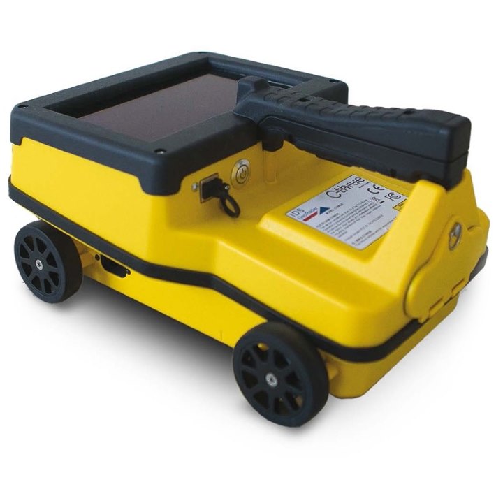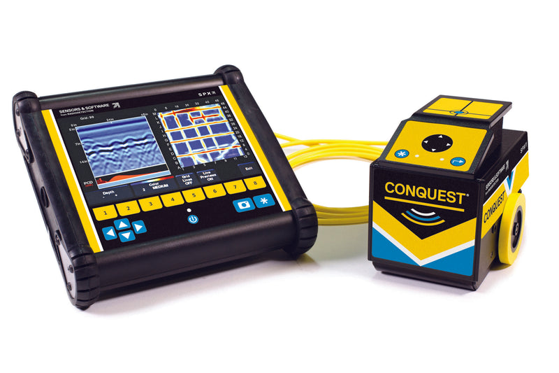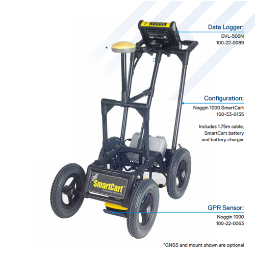
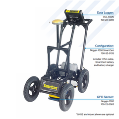
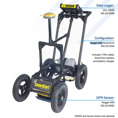
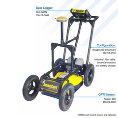

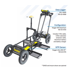


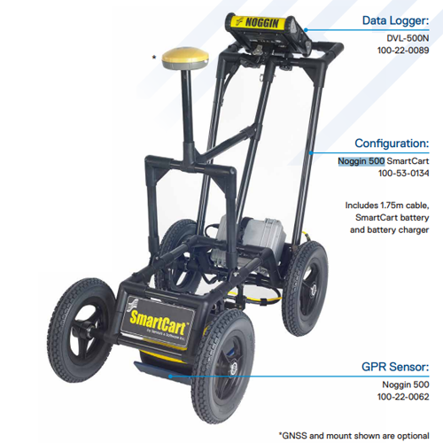


Systems include DVL-500, GPR sensor, configuration, cable, battery and charger
NOGGIN® GPR systems have been recognized by leading researchers as providing the highest quality GPR data in the world. They are also built to perform in the most demanding conditions around the globe.
Adaptable, proven GPR for any application
Available in four center frequencies and five standard configurations, NOGGIN® systems can collect data in any environment for any application. NOGGIN® spans the depths and resolutions required for subsurface investigations. Choose the combination of center frequency and configuration best suited to your application and terrain.
| NOGGIN® | ||||||
|---|---|---|---|---|---|---|

|

|

|

|
|||
| Configuration | Applications (right) Terrain (below) |
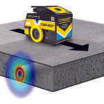
Geologic mapping, geotechnical applications and deep subsurface utility mapping | SUM/SUE, Underground storage tanks (UST), Drainage systems | Archaeology, Forensics | Pavement, Bridge deck, concrete assessment | |
|
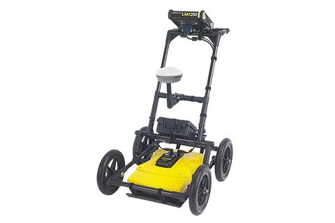
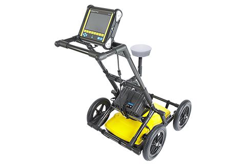
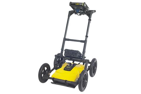
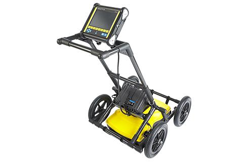
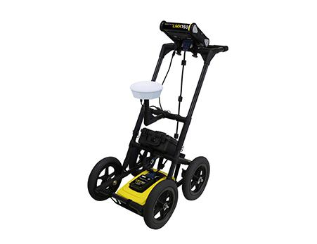
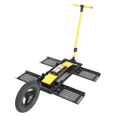
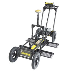
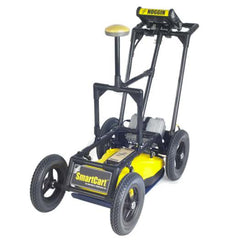
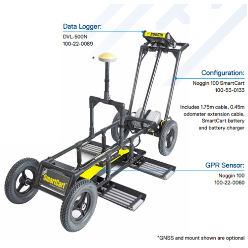
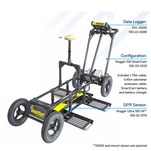
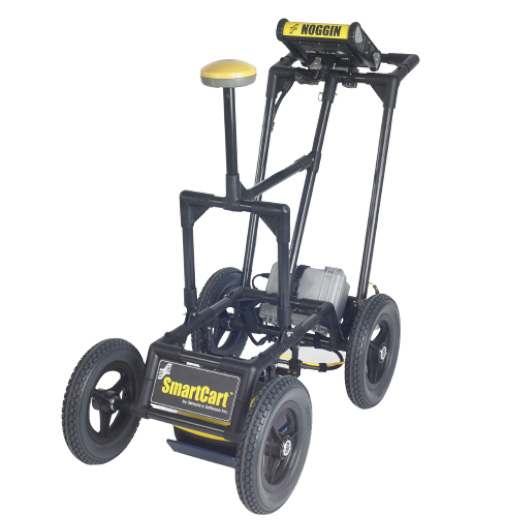
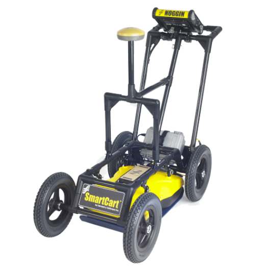
SmartCart: Durable, 4-wheeled, folding cart |
Most terrains; flat to moderately rough |  |
 |
 |
 |
|
|
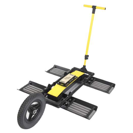
SmartTow: Light, compact Tow |
Rough or difficult terrain; steep hills |  |
 |
 |
 |
|
|
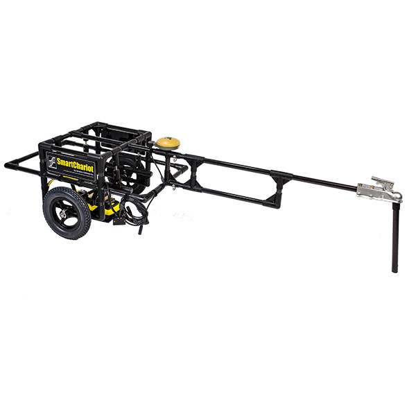
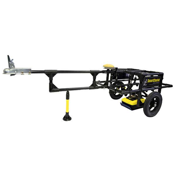
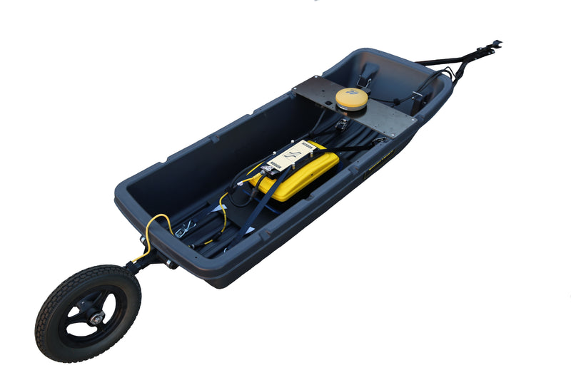
SmartChariot: Trailer attaches to any vehicle with a hitch |
Large, flat, open areas; roads, parks, golf courses | N/A |  |
 |
 |
|
|
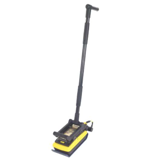
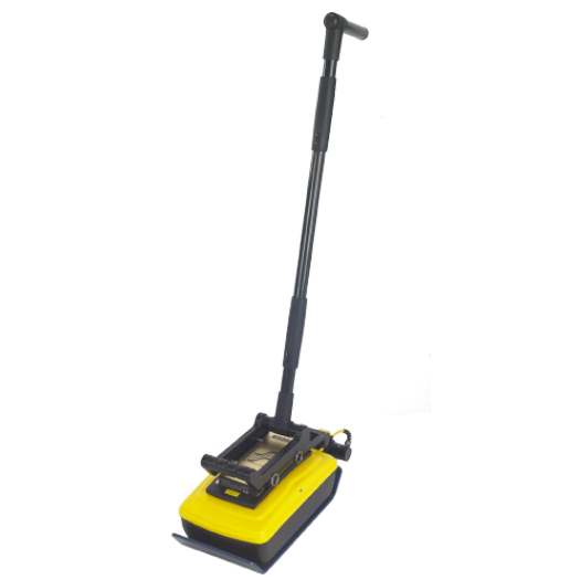
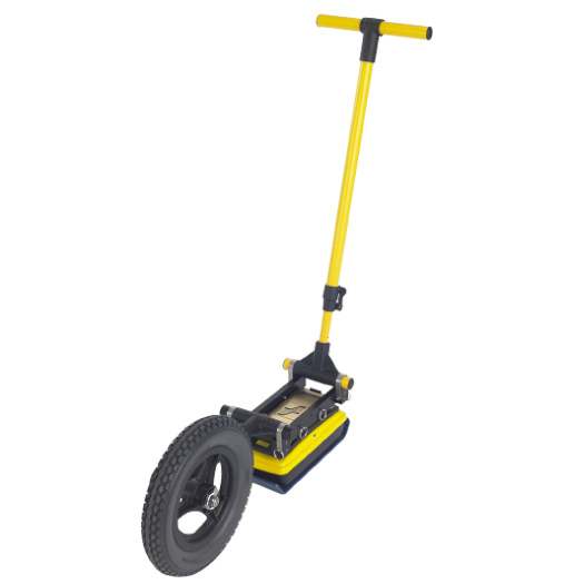
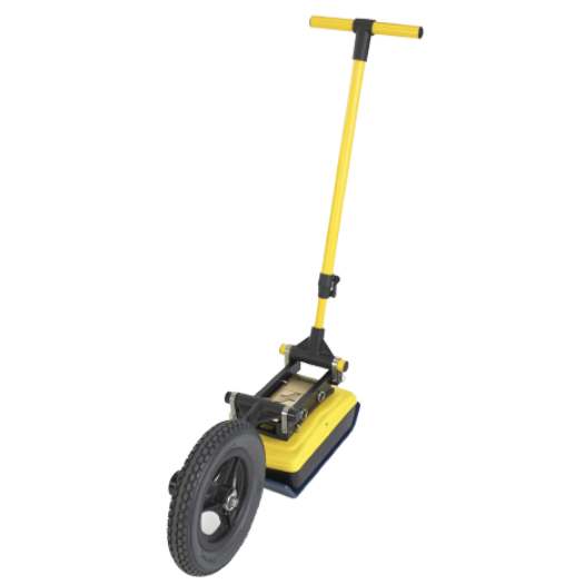
SmartHandle: Light, compact pull or push |
Vertical or overhead surfaces; confined spaces | N/A | N/A |  |
 |
|
|
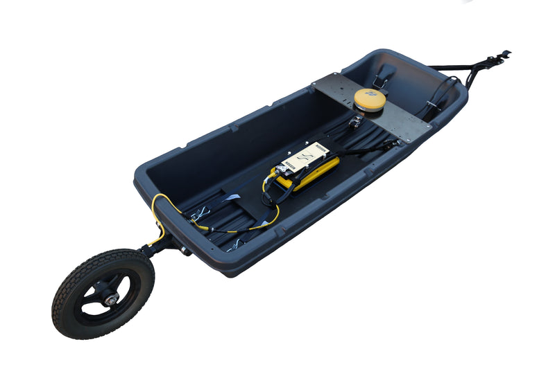
SmartSled: Towed behind any vehicle |
Large, open, rough terrains | N/A |  |
 |
 |
|


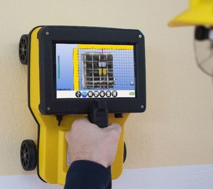
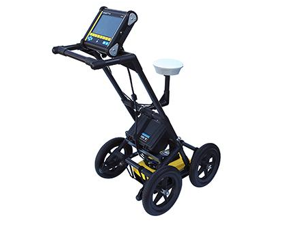
Adjust data collection parameters and easily view data in the field with the high resolution, sunlight visible, touchscreen digital video logger (DVL).

 |
|
|---|
The data collection software on the DVL 500 Noggins have default settings to get to work quickly; for line surveys just set the desired depth and start collecting.
For grid collection, the GPR operator sets the grid size and line spacing. The screen prompts the user to collect each line until the grid is complete. It is easy to work around obstructions, skip lines or recollect lines if required.
Once the grid is finished (or any time after at least 3 lines have been collected), the grid data can be processed into depth slices (right in the field!).
- Depths to 200 meters (320 m in ice)
- Triggering options include Odometer, Button and Free-Run modes
- Free Run in Time or Free-Run with Speed to collect data on water, snow or ice
- Grids up to 250 x 250m in size
- Zig-zag grid collection pattern
- Step Sizes from 5 millimeters to 5 meters
After data collection is finished, transfer the data to your computer and organize, edit, process, and plot your GPR data with the optional EKKO_Project™ Software bundles. Visualize your data in seconds – spend your time understanding the data and reporting your findings

Download
| Shipping | This Item Ships from Fremantle, Perth, Western Australia |
Please allow 2 - 10 days for your order to arrive.
Although Most Stocked Products will generally Ship Overnight. We source products from all over the world to bring you epic offers and the lowest prices. This means sometimes you have to wait a little longer to get your order but it's always worth it!
Returns are easy.
simply contact us for a returns number and send your item to our returns centre for fast processing. We'll get you a replacement or refund in a snap!
Description
Systems include DVL-500, GPR sensor, configuration, cable, battery and charger
NOGGIN® GPR systems have been recognized by leading researchers as providing the highest quality GPR data in the world. They are also built to perform in the most demanding conditions around the globe.
Adaptable, proven GPR for any application
Available in four center frequencies and five standard configurations, NOGGIN® systems can collect data in any environment for any application. NOGGIN® spans the depths and resolutions required for subsurface investigations. Choose the combination of center frequency and configuration best suited to your application and terrain.
| NOGGIN® | ||||||
|---|---|---|---|---|---|---|
|
|
|
|
|
|||
| Configuration | Applications (right) Terrain (below) |
Geologic mapping, geotechnical applications and deep subsurface utility mapping | SUM/SUE, Underground storage tanks (UST), Drainage systems | Archaeology, Forensics | Pavement, Bridge deck, concrete assessment | |
|
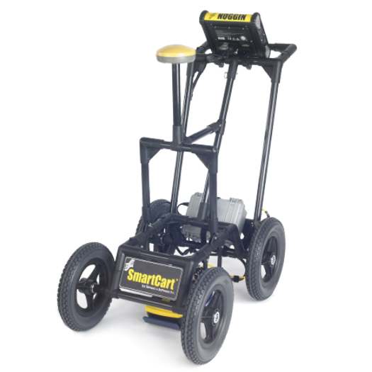
SmartCart: Durable, 4-wheeled, folding cart |
Most terrains; flat to moderately rough | |
|
|
|
|
|
SmartTow: Light, compact Tow |
Rough or difficult terrain; steep hills | |
|
|
|
|
|
SmartChariot: Trailer attaches to any vehicle with a hitch |
Large, flat, open areas; roads, parks, golf courses | N/A | |
|
|
|
|
SmartHandle: Light, compact pull or push |
Vertical or overhead surfaces; confined spaces | N/A | N/A | |
|
|
|
SmartSled: Towed behind any vehicle |
Large, open, rough terrains | N/A | |
|
|
|
Adjust data collection parameters and easily view data in the field with the high resolution, sunlight visible, touchscreen digital video logger (DVL).
|
|
|---|
The data collection software on the DVL 500 Noggins have default settings to get to work quickly; for line surveys just set the desired depth and start collecting.
For grid collection, the GPR operator sets the grid size and line spacing. The screen prompts the user to collect each line until the grid is complete. It is easy to work around obstructions, skip lines or recollect lines if required.
Once the grid is finished (or any time after at least 3 lines have been collected), the grid data can be processed into depth slices (right in the field!).
- Depths to 200 meters (320 m in ice)
- Triggering options include Odometer, Button and Free-Run modes
- Free Run in Time or Free-Run with Speed to collect data on water, snow or ice
- Grids up to 250 x 250m in size
- Zig-zag grid collection pattern
- Step Sizes from 5 millimeters to 5 meters
After data collection is finished, transfer the data to your computer and organize, edit, process, and plot your GPR data with the optional EKKO_Project™ Software bundles. Visualize your data in seconds – spend your time understanding the data and reporting your findings
Download
Shipping
| Shipping | This item ships to |
Delivery & Returns
Please allow 2 - 10 days for your order to arrive.
Although Most Stocked Products will generally Ship Overnight. We source products from all over the world to bring you epic offers and the lowest prices. This means sometimes you have to wait a little longer to get your order but it's always worth it!
Returns are easy.
simply contact us for a returns number and send your item to our returns centre for fast processing. We'll get you a replacement or refund in a snap!
6 Great reasons to buy from us:
-

30 Days Return
If your product is faulty or damaged under manufacture warranty, simply send it back to us and we'll cheerfully replace it or fix the problem for you. -

Returns are Easy
Simply contact us for a returns number and send your item to our returns centre for fast processing. We'll get you a replacement or refund in a snap! -

Best Price Guarantee
In the unlikely event that you find your item cheaper at another online store, just let us know and we'll beat the competitor's pricing hands-down. -

We guarantee your satisfaction
We insist that you love everything you buy from us. If you're unhappy for any reason whatsoever, just let us know and we'll bend over backwards to make things right again. -

100% Safe & Secure
Ordering from Laserman Technologies is 100% safe and secure so you can rest easy. Your personal details are never shared, sold or rented to anyone either. -

Best Laser Warranties in the Business
Laserman the Best Laser Level, Pipe Laser and Laser Measuring Warranties in the Business - Now thats unbeatable value !!.


Related Products