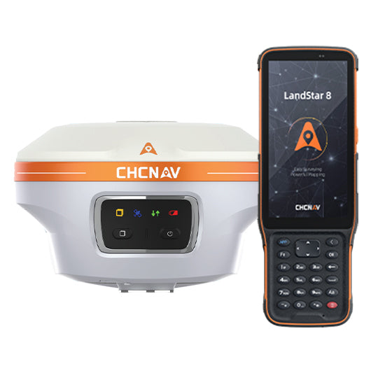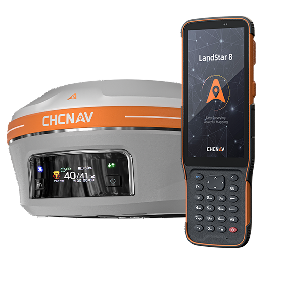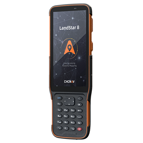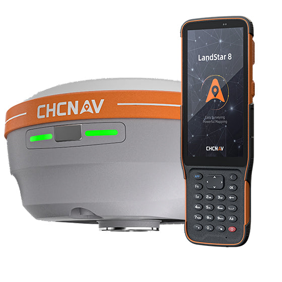
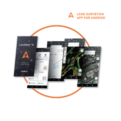

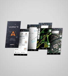

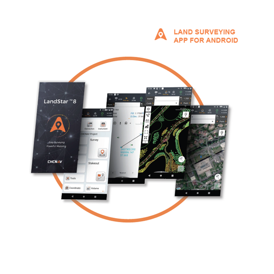

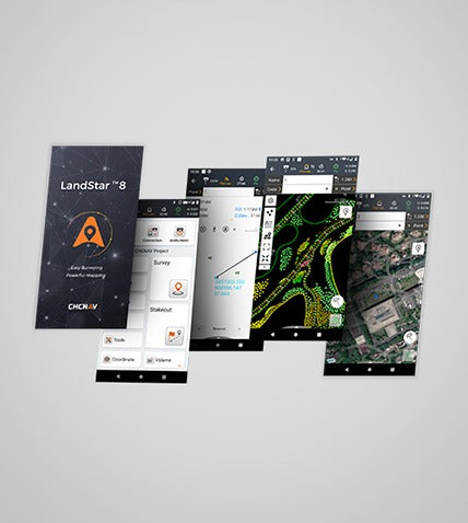
CHCNAV LandStar 8
Land Surveying and Mapping App

Highlights
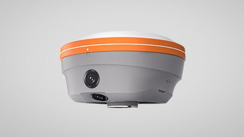
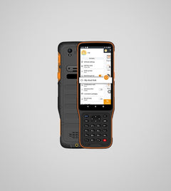
LandStar 8 is a trusted data collection app for Android devices and CHCNAV controllers, streamlining high-precision surveying and mapping with easy-to-use workflows and an intuitive graphical interface. It includes all necessary surveying functions such as construction surveying, control point measurements, CAD support, and efficient stakeout of points, lines, and surfaces. Compatible with industry-standard data formats for seamless import and export, LandStar 8 ensures immediate productivity gains.
Main Features
MetaCAD Engine
Open DWG and DXF base maps fast and with smoother rendering.
Cloud Connectivity
Project backup, collaborative work and remote support.
Modular
Customizable user interface for ease-of-use.
Comprehensive
Construction surveying, CAD support, and efficient stakeout.
Benefits and Performances
Comprehensive Surveying Features
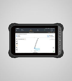
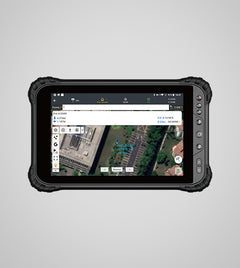
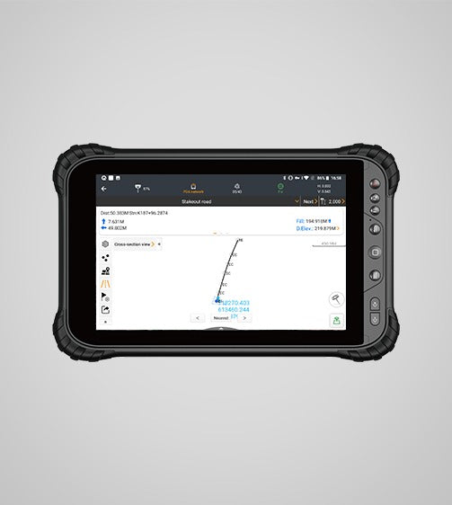
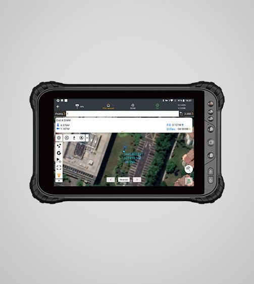
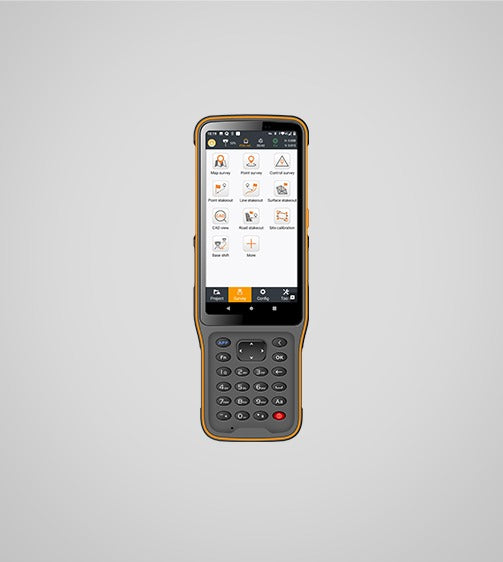
Use LandStar 8 for construction surveying, control point measurement, native CAD files support, fast and accurate point, line and surface stakeout, road construction and GIS data collection.
Advanced CAD Mapping
LandStar 8's proprietary MetaCAD graphics engine opens DWG and DXF files faster and with smoother rendering. The app supports DXF files up to 200 MB and smart functions like "Quick Code" automate feature coding to increase productivity.
Efficient Project Management
Get started quickly with LandStar 8's easy project setup. Copy coordinate settings, control points, and stakeout points from another controller and use coordinate systems, geoid models, and code libraries.
Enhanced Data Import/Export
LandStar 8's comprehensive import and export format support ensures seamless integration into existing software environments. The application is compatible with industry-standard data formats for easy data sharing and integration.
Extended Cloud Connectivity
LandStar 8's cloud-based architecture supports project backup, collaboration, data storage, and remote support capabilities, enabling efficient communication between the field and the office.
User-Friendly Interface
LandStar 8's intuitive layout makes surveying and mapping easy. Large map windows and graphics display only relevant information, hiding unused features and streamlining operations.
Specifications
System
Operating system : Android
Languages : Over 35 supported
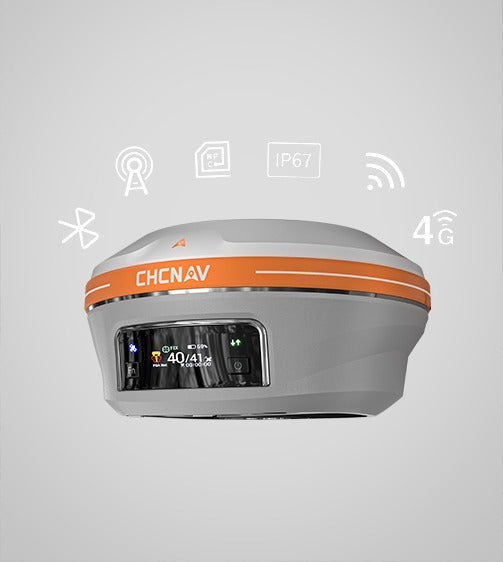
Connectivity
Device : Bluetooth, Wi-Fi
Cloud : Data storage and remote support
Interface
User menu : Customizable
Online basemaps : Google, Bing, WMS, WFS
Features
Functions : Data collection, stakeouts and more.
File formats : SHP, DWG, DXF, KML, GPX, TIFF, JPG, MBTiles
| Shipping | This Item Ships from Fremantle, Perth, Western Australia |
Please allow 2 - 10 days for your order to arrive.
Although Most Stocked Products will generally Ship Overnight. We source products from all over the world to bring you epic offers and the lowest prices. This means sometimes you have to wait a little longer to get your order but it's always worth it!
Returns are easy.
simply contact us for a returns number and send your item to our returns centre for fast processing. We'll get you a replacement or refund in a snap!
Description
CHCNAV LandStar 8
Land Surveying and Mapping App
Highlights
LandStar 8 is a trusted data collection app for Android devices and CHCNAV controllers, streamlining high-precision surveying and mapping with easy-to-use workflows and an intuitive graphical interface. It includes all necessary surveying functions such as construction surveying, control point measurements, CAD support, and efficient stakeout of points, lines, and surfaces. Compatible with industry-standard data formats for seamless import and export, LandStar 8 ensures immediate productivity gains.
Main Features
MetaCAD Engine
Open DWG and DXF base maps fast and with smoother rendering.
Cloud Connectivity
Project backup, collaborative work and remote support.
Modular
Customizable user interface for ease-of-use.
Comprehensive
Construction surveying, CAD support, and efficient stakeout.
Benefits and Performances
Comprehensive Surveying Features
Use LandStar 8 for construction surveying, control point measurement, native CAD files support, fast and accurate point, line and surface stakeout, road construction and GIS data collection.
Advanced CAD Mapping
LandStar 8's proprietary MetaCAD graphics engine opens DWG and DXF files faster and with smoother rendering. The app supports DXF files up to 200 MB and smart functions like "Quick Code" automate feature coding to increase productivity.
Efficient Project Management
Get started quickly with LandStar 8's easy project setup. Copy coordinate settings, control points, and stakeout points from another controller and use coordinate systems, geoid models, and code libraries.
Enhanced Data Import/Export
LandStar 8's comprehensive import and export format support ensures seamless integration into existing software environments. The application is compatible with industry-standard data formats for easy data sharing and integration.
Extended Cloud Connectivity
LandStar 8's cloud-based architecture supports project backup, collaboration, data storage, and remote support capabilities, enabling efficient communication between the field and the office.
User-Friendly Interface
LandStar 8's intuitive layout makes surveying and mapping easy. Large map windows and graphics display only relevant information, hiding unused features and streamlining operations.
Specifications
System
Operating system : Android
Languages : Over 35 supported
Connectivity
Device : Bluetooth, Wi-Fi
Cloud : Data storage and remote support
Interface
User menu : Customizable
Online basemaps : Google, Bing, WMS, WFS
Features
Functions : Data collection, stakeouts and more.
File formats : SHP, DWG, DXF, KML, GPX, TIFF, JPG, MBTiles
Shipping
| Shipping | This item ships to |
Delivery & Returns
Please allow 2 - 10 days for your order to arrive.
Although Most Stocked Products will generally Ship Overnight. We source products from all over the world to bring you epic offers and the lowest prices. This means sometimes you have to wait a little longer to get your order but it's always worth it!
Returns are easy.
simply contact us for a returns number and send your item to our returns centre for fast processing. We'll get you a replacement or refund in a snap!
6 Great reasons to buy from us:
-

30 Days Return
If your product is faulty or damaged under manufacture warranty, simply send it back to us and we'll cheerfully replace it or fix the problem for you. -

Returns are Easy
Simply contact us for a returns number and send your item to our returns centre for fast processing. We'll get you a replacement or refund in a snap! -

Best Price Guarantee
In the unlikely event that you find your item cheaper at another online store, just let us know and we'll beat the competitor's pricing hands-down. -

We guarantee your satisfaction
We insist that you love everything you buy from us. If you're unhappy for any reason whatsoever, just let us know and we'll bend over backwards to make things right again. -

100% Safe & Secure
Ordering from Laserman Technologies is 100% safe and secure so you can rest easy. Your personal details are never shared, sold or rented to anyone either. -

Best Laser Warranties in the Business
Laserman the Best Laser Level, Pipe Laser and Laser Measuring Warranties in the Business - Now thats unbeatable value !!.