


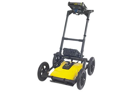
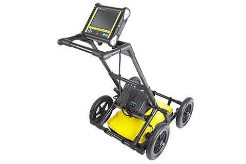
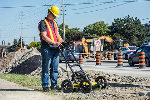
LMX100™ GPR
Ground Penetrating Radar (GPR)
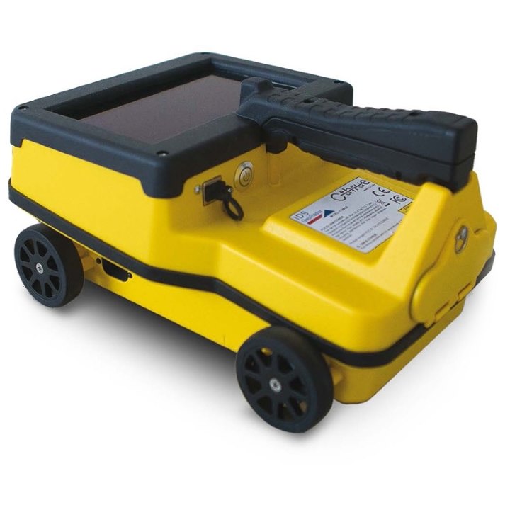
Our Sensors & Software LMX100™ completes the locator’s toolbox, offering a more complete picture of the underground infrastructure. With a simple, easy-to-use interface it also offers the perfect balance of depth penetration and high resolution for accurate locating.
LMX has the advantage of detecting:
- Metallic and non-metallic utilities
- Utilities with broken tracer wires
- Undocumented utilities
- Trenches and disturbed soil often associated with utility burial
- Unexpected obstacles or buried structures such as old foundations that can cause problems for excavations or construction
Features
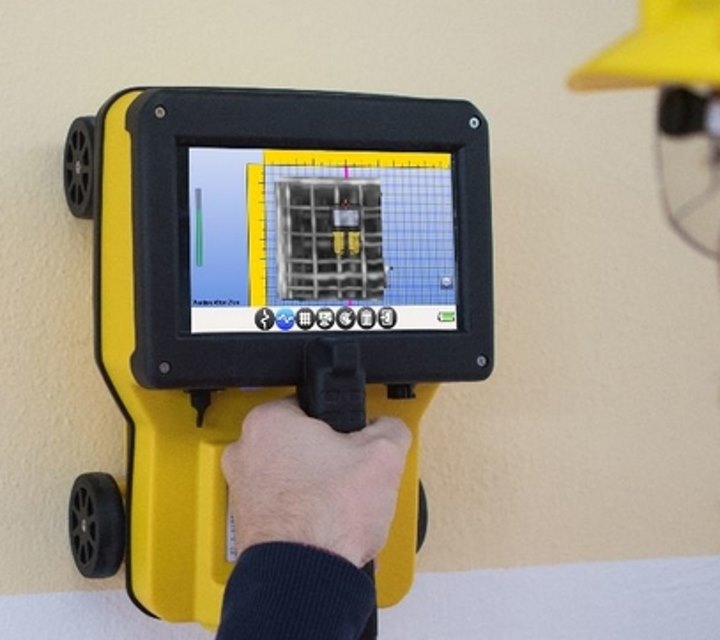
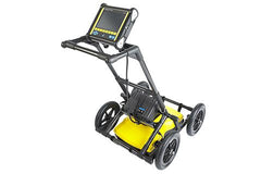
High visibility touch screen
A resistive touch screen that works with gloves on, with user selectable languages and metric and US standard options.
Produce and share instant on-site reports
Share directly from your display unit with built-in Wi-Fi. Option to add data markers to highlight points of interest.
Lightweight build
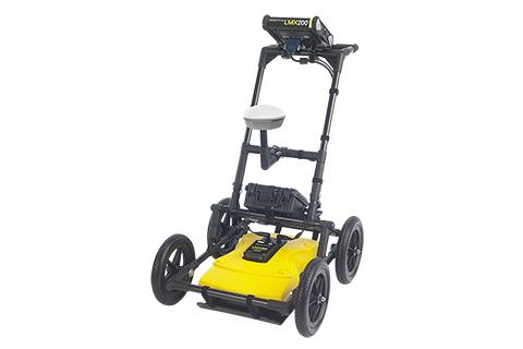
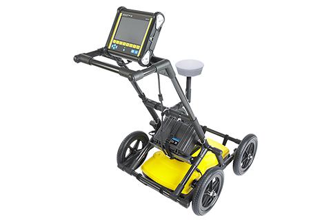
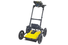
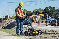
A lightweight fiberglass cart frame build making transportation easy. No metal in the build reduces interference with GPR signals.
GPR Sensor
Patented ultra-wideband (UWB) 250 MHz GPR antenna and DynaT for dynamic target enhancement.
USB port
A USB port allowing for easy data transfer for further data analysis.
Lead acid gel battery
A long lasting and swappable batter
Comparison
Line Scan Mode |
|||||
| Features | Description | Demo | LMX100™ | LMX150™ FINDAR | LMX200™ |
|---|---|---|---|---|---|
| Real time Locate & Mark™ | Acquire data along a line and view it as a cross-section image
|
✓ | ✓ | ✓ | |
| Line Data playback | Save and view any collected line data
|
✕ | ✓ | ✓ | |
| Back-up indicator | After acquiring some data on the screen, pull the system backwards to pinpoint target location
|
✓ | ✓ | ✓ | |
| Position & Depth Indicator | Crosshair on back-up indicator shows current position and depth
|
✓ | ✓ | ✓ | |
| Pop up info box | Touch and hold the screen to generate a movable depth and position info box
|
✓ | ✓ | ✓ | |
| Pause Button | In No Save Mode, temporarily stop data collection and resume again without clearing the data from the screen
|
✓ | ✓ | ✓ | |
| Drawing arrows | In No Save Mode, draw arrows on the screen to highlight features
|
✓ | ✓ | ✓ | |
| GPS Status indicator | Indicates the signal quality of the selected GPS (internal or external)
|
✕ | ✓ | ✓ | |
| SplitView | During data collection, display LineView and MapView simultaneously to quickly see the positional relationship between targets (external GPS only)
|
✕ | ✓ | ✓ | |
Real time viewing options in Line Scan |
|||||
| Features | Description | Demo | LMX100™ | LMX150™ FINDAR | LMX200™ |
|---|---|---|---|---|---|
| Zoom – Position | Vary the length of data displayed on the screen
|
✓ | ✓ | ✓ | |
| Zoom – Depth | Vary the depth of data displayed on the screen
|
✓ | ✓ | ✓ | |
| Color | View data with different color palettes
|
✓ | ✓ | ✓ | |
| Filter | Filter out flat-lying responses in the data using 5 preset filter levels
|
✓ | ✓ | ✓ | |
| Gain | Adjust amplification of GPR data to make weaker or deeper targets visible
|
✓ | ✓ | ✓ | |
| Soil Cal | Calibrate velocity for accurate depth measurements; hyperbola-fitting method or select from available pre-set Soil Cal values
|
✓ | ✓ | ✓ | |
| Interpretations | Mark subsurface features as a colored dot by touching anywhere on the screen
|
✕ | ✓ | ✓ | |
| Flags | Mark noteworthy above-ground features with sequentially numbered flags
|
✓ | ✓ | ✓ | |
Grid Scan Mode |
|||||
| Features | Description | Demo | LMX100™ | LMX150™ FINDAR | LMX200™ |
|---|---|---|---|---|---|
| On site grid scan | Collect grid data and generate depth slices in the field
|
✕ | ✓ | ✓ | |
| Guided grid setup | Select grid size and resolution
|
✕ | ✓ | ✓ | |
| Guided data collection on the Display unit | Guides user through data collection with intuitive visual and audio prompts.
|
✕ | ✓ | ✓ | |
| Recollect grid lines | Recollect any grid line if you make a mistake
|
✕ | ✓ | ✓ | |
| Collect partial grid lines | Stop any grid line early to avoid an obstacle
|
✕ | ✓ | ✓ | |
| Skip grid lines | Skip a grid line with a touch of a button if the line does not need to be collected
|
✕ | ✓ | ✓ | |
| Obstacle Avoidance | The system guides you through collecting a grid around an obstacle
|
✕ | ✓ | ✓ | |
| Depth slices from incomplete grids | Generate depth slices with an incomplete grid
|
✕ | ✓ | ✓ | |
| Grid line playback | View previously collected grid lines |
✕ | ✓ | ✓ | |
SliceView |
|||||
| Features | Description | Demo | LMX100™ | LMX150™ FINDAR | LMX200™ |
|---|---|---|---|---|---|
| View depth slices | Scroll through depths and adjust viewing options
|
✕ | ✓ | ✓ | |
| Correlate depth slices to grid lines | View the grid line corresponding to a feature in a depth slice
|
✕ | ✓ | ✓ | |
| Depth slice Indicator | Display any grid line and scroll down through the depth slices with the depth slice range indicated on the grid line.
|
✕ | ✓ | ✓ | |
| LineView Mode | View grid line in LineView to add interpretations and adjust viewing options
|
✕ | ✓ | ✓ | |
Additional Features |
|||||
| Features | Description | Demo | LMX100™ | LMX150™ FINDAR | LMX200™ |
|---|---|---|---|---|---|
| MapView | Graphically view the path travelled by the system, any flags or interpretations added as well as the ability to cycle through processed depth slices (External GPS only)
|
✕ | ✓ | ✓ | |
| MapView (Internal GPS) | Graphically show collected grid locations and processed depth slices |
✕ | ✓ | ✓ | |
| External GPS port | Option to connect an external GPS for increased positional accuracy
|
✕ | ✓ | ✓ | |
| Screenshots | Saves the current screen image to a JPG file
|
✓ | ✓ | ✓ | |
| DynaQ | Dynamic Quality Enhancement – Automatically adjusts data quality based on system speed
|
✓ | ✓ | ✓ | |
| DynaT | Dynamic Target Enhancement – allows the user to selectively view small, medium or large subsurface targets for easier viewing and detection
|
✓ | ✓ | ✓ | |
| File Management | Data is logically organized for review and transfer
|
✓ Screenshots |
✓ Projects containing Lines, Grids & Screenshots |
✓ Projects containing Lines, Grids & Screenshots |
|
Data Export |
|||||
| Features | Description | Demo | LMX100™ | LMX150™ FINDAR | LMX200™ |
|---|---|---|---|---|---|
| USB data transfer | One click data export to a USB drive
|
✓ | ✓ | ✓ | |
| Field Interpretations file (.CSV) | Positional information for interpretations and flags automatically exported as a .CSV file
|
✕ | ✓ | ✓ | |
| Geotagged Screenshots (.JPG) | Exports screenshots as JPG files
|
✓ | ✓ | ✓ | |
| KMZ Files | Screenshots, survey paths and field interpretations are automatically exported to .KMZ files for viewing in Google Earth™
|
✓ Screenshots Only |
✓ | ✓ | |
| Project files (.GPZ) | All data (lines, grids & screenshots) in a project are saved as a .GPZ file
|
✕ | ✓ | ✓ | |
| Wi-Fi Mini Reports | From the field, email reports containing screenshots and information about the collected data
|
✓ | ✓ | ✓ | |
| System usage report | A PDF report containing usage statistics and system diagnostics
|
✓ | ✓ | ✓ | |
GPR Analysis and Reporting Software |
|||||
| Features | Description | Demo | LMX100™ | LMX150™ FINDAR | LMX200™ |
|---|---|---|---|---|---|
| GPR Data Export to optional EKKO_Project™ Core | Open project files to organize data files, view data and generate reports
|
✕ | ✓ | ✓ | |
| EKKO_Project™ GPR Software Bundles | Software bundles for added data processing, analysis and visualization
|
✕ | ✓ | ✓ | |
GPR System Specifications |
|||||
| Features | Description | Demo | LMX100™ | LMX150™ FINDAR | LMX200™ |
|---|---|---|---|---|---|
| Center Frequency (MHz) | Center frequency of GPR system
|
250 | 500 | 250 | |
| Weight | Lightweight GPR system
|
22 kg (48 lb) | 19 kg (41lb) | 22 kg (48 lb) | |
| System Size | Compact GPR Cart
|
100 x 70 x 115 cm (39.4 x 27.6 x 45.3 in) |
115 × 55 × 90 cm (45 × 21 × 35 in) |
100 x 70 x 115 cm (39.4 x 27.6 x 45.3 in) |
|
| Max Depth | Maximum depth of data collected and displayed on the display unit
|
8 m (26 ft) | 3 m (10 ft) | 8 m (26 ft) | |
Downloads
| Shipping | This Item Ships from Fremantle, Perth, Western Australia |
Please allow 2 - 10 days for your order to arrive.
Although Most Stocked Products will generally Ship Overnight. We source products from all over the world to bring you epic offers and the lowest prices. This means sometimes you have to wait a little longer to get your order but it's always worth it!
Returns are easy.
simply contact us for a returns number and send your item to our returns centre for fast processing. We'll get you a replacement or refund in a snap!
Description
LMX100™ GPR
Ground Penetrating Radar (GPR)
Our Sensors & Software LMX100™ completes the locator’s toolbox, offering a more complete picture of the underground infrastructure. With a simple, easy-to-use interface it also offers the perfect balance of depth penetration and high resolution for accurate locating.
LMX has the advantage of detecting:
- Metallic and non-metallic utilities
- Utilities with broken tracer wires
- Undocumented utilities
- Trenches and disturbed soil often associated with utility burial
- Unexpected obstacles or buried structures such as old foundations that can cause problems for excavations or construction
Features
High visibility touch screen
A resistive touch screen that works with gloves on, with user selectable languages and metric and US standard options.
Produce and share instant on-site reports
Share directly from your display unit with built-in Wi-Fi. Option to add data markers to highlight points of interest.
Lightweight build
A lightweight fiberglass cart frame build making transportation easy. No metal in the build reduces interference with GPR signals.
GPR Sensor
Patented ultra-wideband (UWB) 250 MHz GPR antenna and DynaT for dynamic target enhancement.
USB port
A USB port allowing for easy data transfer for further data analysis.
Lead acid gel battery
A long lasting and swappable batter
Comparison
Line Scan Mode |
|||||
| Features | Description | Demo | LMX100™ | LMX150™ FINDAR | LMX200™ |
|---|---|---|---|---|---|
| Real time Locate & Mark™ | Acquire data along a line and view it as a cross-section image
|
✓ | ✓ | ✓ | |
| Line Data playback | Save and view any collected line data
|
✕ | ✓ | ✓ | |
| Back-up indicator | After acquiring some data on the screen, pull the system backwards to pinpoint target location
|
✓ | ✓ | ✓ | |
| Position & Depth Indicator | Crosshair on back-up indicator shows current position and depth
|
✓ | ✓ | ✓ | |
| Pop up info box | Touch and hold the screen to generate a movable depth and position info box
|
✓ | ✓ | ✓ | |
| Pause Button | In No Save Mode, temporarily stop data collection and resume again without clearing the data from the screen
|
✓ | ✓ | ✓ | |
| Drawing arrows | In No Save Mode, draw arrows on the screen to highlight features
|
✓ | ✓ | ✓ | |
| GPS Status indicator | Indicates the signal quality of the selected GPS (internal or external)
|
✕ | ✓ | ✓ | |
| SplitView | During data collection, display LineView and MapView simultaneously to quickly see the positional relationship between targets (external GPS only)
|
✕ | ✓ | ✓ | |
Real time viewing options in Line Scan |
|||||
| Features | Description | Demo | LMX100™ | LMX150™ FINDAR | LMX200™ |
|---|---|---|---|---|---|
| Zoom – Position | Vary the length of data displayed on the screen
|
✓ | ✓ | ✓ | |
| Zoom – Depth | Vary the depth of data displayed on the screen
|
✓ | ✓ | ✓ | |
| Color | View data with different color palettes
|
✓ | ✓ | ✓ | |
| Filter | Filter out flat-lying responses in the data using 5 preset filter levels
|
✓ | ✓ | ✓ | |
| Gain | Adjust amplification of GPR data to make weaker or deeper targets visible
|
✓ | ✓ | ✓ | |
| Soil Cal | Calibrate velocity for accurate depth measurements; hyperbola-fitting method or select from available pre-set Soil Cal values
|
✓ | ✓ | ✓ | |
| Interpretations | Mark subsurface features as a colored dot by touching anywhere on the screen
|
✕ | ✓ | ✓ | |
| Flags | Mark noteworthy above-ground features with sequentially numbered flags
|
✓ | ✓ | ✓ | |
Grid Scan Mode |
|||||
| Features | Description | Demo | LMX100™ | LMX150™ FINDAR | LMX200™ |
|---|---|---|---|---|---|
| On site grid scan | Collect grid data and generate depth slices in the field
|
✕ | ✓ | ✓ | |
| Guided grid setup | Select grid size and resolution
|
✕ | ✓ | ✓ | |
| Guided data collection on the Display unit | Guides user through data collection with intuitive visual and audio prompts.
|
✕ | ✓ | ✓ | |
| Recollect grid lines | Recollect any grid line if you make a mistake
|
✕ | ✓ | ✓ | |
| Collect partial grid lines | Stop any grid line early to avoid an obstacle
|
✕ | ✓ | ✓ | |
| Skip grid lines | Skip a grid line with a touch of a button if the line does not need to be collected
|
✕ | ✓ | ✓ | |
| Obstacle Avoidance | The system guides you through collecting a grid around an obstacle
|
✕ | ✓ | ✓ | |
| Depth slices from incomplete grids | Generate depth slices with an incomplete grid
|
✕ | ✓ | ✓ | |
| Grid line playback | View previously collected grid lines |
✕ | ✓ | ✓ | |
SliceView |
|||||
| Features | Description | Demo | LMX100™ | LMX150™ FINDAR | LMX200™ |
|---|---|---|---|---|---|
| View depth slices | Scroll through depths and adjust viewing options
|
✕ | ✓ | ✓ | |
| Correlate depth slices to grid lines | View the grid line corresponding to a feature in a depth slice
|
✕ | ✓ | ✓ | |
| Depth slice Indicator | Display any grid line and scroll down through the depth slices with the depth slice range indicated on the grid line.
|
✕ | ✓ | ✓ | |
| LineView Mode | View grid line in LineView to add interpretations and adjust viewing options
|
✕ | ✓ | ✓ | |
Additional Features |
|||||
| Features | Description | Demo | LMX100™ | LMX150™ FINDAR | LMX200™ |
|---|---|---|---|---|---|
| MapView | Graphically view the path travelled by the system, any flags or interpretations added as well as the ability to cycle through processed depth slices (External GPS only)
|
✕ | ✓ | ✓ | |
| MapView (Internal GPS) | Graphically show collected grid locations and processed depth slices |
✕ | ✓ | ✓ | |
| External GPS port | Option to connect an external GPS for increased positional accuracy
|
✕ | ✓ | ✓ | |
| Screenshots | Saves the current screen image to a JPG file
|
✓ | ✓ | ✓ | |
| DynaQ | Dynamic Quality Enhancement – Automatically adjusts data quality based on system speed
|
✓ | ✓ | ✓ | |
| DynaT | Dynamic Target Enhancement – allows the user to selectively view small, medium or large subsurface targets for easier viewing and detection
|
✓ | ✓ | ✓ | |
| File Management | Data is logically organized for review and transfer
|
✓ Screenshots |
✓ Projects containing Lines, Grids & Screenshots |
✓ Projects containing Lines, Grids & Screenshots |
|
Data Export |
|||||
| Features | Description | Demo | LMX100™ | LMX150™ FINDAR | LMX200™ |
|---|---|---|---|---|---|
| USB data transfer | One click data export to a USB drive
|
✓ | ✓ | ✓ | |
| Field Interpretations file (.CSV) | Positional information for interpretations and flags automatically exported as a .CSV file
|
✕ | ✓ | ✓ | |
| Geotagged Screenshots (.JPG) | Exports screenshots as JPG files
|
✓ | ✓ | ✓ | |
| KMZ Files | Screenshots, survey paths and field interpretations are automatically exported to .KMZ files for viewing in Google Earth™
|
✓ Screenshots Only |
✓ | ✓ | |
| Project files (.GPZ) | All data (lines, grids & screenshots) in a project are saved as a .GPZ file
|
✕ | ✓ | ✓ | |
| Wi-Fi Mini Reports | From the field, email reports containing screenshots and information about the collected data
|
✓ | ✓ | ✓ | |
| System usage report | A PDF report containing usage statistics and system diagnostics
|
✓ | ✓ | ✓ | |
GPR Analysis and Reporting Software |
|||||
| Features | Description | Demo | LMX100™ | LMX150™ FINDAR | LMX200™ |
|---|---|---|---|---|---|
| GPR Data Export to optional EKKO_Project™ Core | Open project files to organize data files, view data and generate reports
|
✕ | ✓ | ✓ | |
| EKKO_Project™ GPR Software Bundles | Software bundles for added data processing, analysis and visualization
|
✕ | ✓ | ✓ | |
GPR System Specifications |
|||||
| Features | Description | Demo | LMX100™ | LMX150™ FINDAR | LMX200™ |
|---|---|---|---|---|---|
| Center Frequency (MHz) | Center frequency of GPR system
|
250 | 500 | 250 | |
| Weight | Lightweight GPR system
|
22 kg (48 lb) | 19 kg (41lb) | 22 kg (48 lb) | |
| System Size | Compact GPR Cart
|
100 x 70 x 115 cm (39.4 x 27.6 x 45.3 in) |
115 × 55 × 90 cm (45 × 21 × 35 in) |
100 x 70 x 115 cm (39.4 x 27.6 x 45.3 in) |
|
| Max Depth | Maximum depth of data collected and displayed on the display unit
|
8 m (26 ft) | 3 m (10 ft) | 8 m (26 ft) | |
Downloads
Shipping
| Shipping | This item ships to |
Delivery & Returns
Please allow 2 - 10 days for your order to arrive.
Although Most Stocked Products will generally Ship Overnight. We source products from all over the world to bring you epic offers and the lowest prices. This means sometimes you have to wait a little longer to get your order but it's always worth it!
Returns are easy.
simply contact us for a returns number and send your item to our returns centre for fast processing. We'll get you a replacement or refund in a snap!
6 Great reasons to buy from us:
-

30 Days Return
If your product is faulty or damaged under manufacture warranty, simply send it back to us and we'll cheerfully replace it or fix the problem for you. -

Returns are Easy
Simply contact us for a returns number and send your item to our returns centre for fast processing. We'll get you a replacement or refund in a snap! -

Best Price Guarantee
In the unlikely event that you find your item cheaper at another online store, just let us know and we'll beat the competitor's pricing hands-down. -

We guarantee your satisfaction
We insist that you love everything you buy from us. If you're unhappy for any reason whatsoever, just let us know and we'll bend over backwards to make things right again. -

100% Safe & Secure
Ordering from Laserman Technologies is 100% safe and secure so you can rest easy. Your personal details are never shared, sold or rented to anyone either. -

Best Laser Warranties in the Business
Laserman the Best Laser Level, Pipe Laser and Laser Measuring Warranties in the Business - Now thats unbeatable value !!.